.jpg)
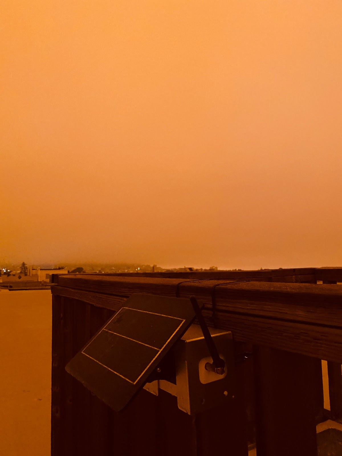
Photos of Clarity Nodes operating in various environmental conditions provided courtesy of Clarity partners Envirosuite, UNESCO, CITRIS, and Brightline Defense.
TL;DR — As climate change progresses and environmental disasters — including wildfires, extreme heat, drought, dust storms, and floods, all of which contribute to air pollution — continue to accelerate, it is more important than ever to invest in resilient infrastructure. Air quality monitoring networks are no exception, as resilient air quality measurement infrastructure ensures access to air quality information before, during, and after disaster strikes. Many traditional air quality monitors depend on vulnerable infrastructures like WiFi and electrical grids that can easily go down during environmental disasters, leaving behind inaccurate or absent air quality information. Establishing resilient air quality monitoring networks helps us be more resilient in the face of disaster and is an important step towards safeguarding human and environmental health in the face of a changing climate.
Infrastructure failure due to environmental disaster
As climate change has accelerated over recent years, so have the number of natural disasters that threaten human and environmental health.
A disaster is a hazard resulting in significant damage to the physical earth, the environment, and/or a loss of life. Disasters can have either natural or anthropogenic sources, or a combination of both, and may have a sudden onset or develop over the course of time.
A report by the World Meteorological Organization (WMO) released in August 2021 found that the annual incidence of natural disasters worldwide driven by more extreme weather (driven at least in part by climate change) or water hazards has increased by 500 percent over the last 50 years.”

When disasters strike, infrastructure can quickly fail, leading to even greater damage. A CNN article finds that this summer’s heat wave in Europe has caused a host of infrastructure failures, necessitating that action be taken to prevent greater damage. For example, extreme heat in London caused an airport runway to lift, forcing flights to be suspended while the runway was repaired, while the London Bridge was covered in foil as part of a cooling system designed to reflect sunlight and keep the bridge at a moderate temperature. Railroads in Europe have even been painted white to reflect sunlight, as heat causes them to expand and develop kinks that disrupt train usage.
This damage is not exclusive to Europe. Heatwaves hitting other parts of the globe have caused water pipes to burst in Fort Worth, Texas due to the combined effect of heat and drought, and a museum roof to melt in China.
In addition to road, transport, and water infrastructure failures, disasters such as extreme heat heavily impact electrical grids. In Texas, a recent heatwave caused six power plants to go offline, and this will likely continue to happen since many power grid operators use historical weather to make investment decisions, rather than taking into account the current and projected conditions under our changing climate.
Like any other infrastructure, air quality monitoring infrastructure can also fail during a disaster — but unfortunately in many cases, this is when it is needed the most.
Air quality during environmental disasters
Air quality is often affected during disasters and, depending on the existing infrastructure where the disaster occurs, air quality monitoring infrastructure may go down — especially if the monitoring devices depend on an internet connection or hardwired power connection.
During the 2019 wildfires in Northern California, many air quality monitors were turned off when the power was cut by the Pacific Gas & Electric company in an attempt to prevent further flames. This led to inaccurate and confusing — or sometimes absent — information regarding the air during times of heavy smoke — and as a result we may never know just how severe citizens’ exposure to air pollution was during this incident.
In a world with increasingly frequent and severe disasters, it is essential to have resilient air quality monitoring networks that can collect air quality data and inform residents about their exposure before, during, and after these disasters.
What types of disasters do our air quality monitoring networks need to withstand?

Wildfires
Wildfires are one environmental disaster with well-known impacts on air quality that are heightened due to climate change. Heatwaves and drought conditions — both exacerbated by global warming — can combine with anthropogenic events to create the perfect storm for intense wildfires. Wildfires can burn paints, solvents, and other chemicals in the household, releasing toxic pollutants, and these impacts are not just local — wildfire smoke and toxic haze has been noted to spread across entire geographic regions, thousands of miles away from the wildfire.
Wildfire smoke significantly damages air quality, releasing not only particulate matter but also carbon monoxide, ash participles, methyl chloride, methyl bromide, polynuclear aromatic hydrocarbons, aldehydes, and volatile organic compounds (VOCs).
These disastrous events have vast consequences for human health. In California, agricultural workers have reportedly worked under conditions of heavy wildfire smoke without any of the required protective equipment or safeguards, uncovering a larger issue of employers not following through on legal worker protections under wildfire conditions.
Nearly 60% of farmworkers surveyed in Fresno, Kern, Kings, Madera and Tulare counties said that their employers did not provide N95 masks or that they did not know what N95s were. About 45% reported they were not aware of California’s wildfire smoke protections”
— Valley Public Radio, a collaboration of NPR
This is not just a problem in California. As recently as this month, wildfires burning near London during a record-breaking heatwave have significantly damaged air quality. Fine particulate matter (PM2.5), one of the principal pollutants released by wildfire smoke, is linked to a slew of health problems, such as asthma, lung cancer, stroke, heart disease, low birth weights, diabetes, Alzheimer’s, Parkinson’s, and pulmonary, cardiovascular, and neurological disorders. To learn more about the impacts of PM2.5, read our blog here.
Breathe London’s dense network of Clarity Nodes is being used to monitor air pollution at these major fires in London — all of which have produced peak concentrations of PM2.5 well above the WHO’s recommended 24-hourly average concentration of 15 μg/m. Check out Breathe London’s website here to learn more about their air quality monitoring network.
Extreme temperatures
Extreme heat also causes damage to air quality outside of its contribution to wildfire conditions. Higher temperatures can increase the rate of secondary pollutant formation such as ground-level ozone, increasing smog pollution. Our blog covering ground-level ozone can be found here, going into greater depth on how this pollutant impacts the state of the air.
Even extreme cold temperatures coming from cold waves impact air quality, as they can reduce pollutant dispersion and trap pollutants in the atmosphere. And although climate change is sometimes referred to as “global warming”, it can mean more extreme temperatures in both directions — for example, in 2011 Chicago had a historic blizzard, so-called ‘Snowmageddon’, where 21.2 inches of snow fell during a 3-day period, making it the third largest snowstorm ever in Chicago. The blizzard accounted for school cancellations, airport shutdowns, traffic accidents, and left many residents without power, even leading to some deaths during a 40-hour period of constant snowfall.
Scientists connect certain aspects of the blizzard to the ways that climate change affects weather patterns. For example, a warming atmosphere holds more water vapor and can therefore lead to heavier snowfall that occurs in a smaller area. Thundersnow also occurred during Snowmageddon — a characteristic of just 0.07% of snowstorms — which is linked to rare temperature differences.

Sandstorms and dust storms resulting from drought conditions
Droughts can cause sandstorms and dust storms that threaten air quality. In the 1930s, the United States experienced the devastating Dust Bowl, which caused vast damage to both human and environmental health, including ecological harm, crop damage, exacerbation of poverty, and severe respiratory issues in those who lived in the affected regions.
However, dust storms and sandstorms are not a thing of the past. In 2018 in Sudan, a sandstorm engulfed the capital city of Khartoum, causing canceled flights and school shutdowns. Current droughts in Salt Lake City, Utah are threatening ecosystem collapse as the Salt Lake dries up.
Studies have shown that sandstorms and dust storms can increase levels of carbon monoxide, PM2.5, ozone, and nitrogen dioxide.

Not only do sand- and dust storms contribute to air pollution in terms of stirring up pollutants, but they can also transport some viruses and toxic pollutants — such as heavy metals, bacteria, and poisonous minerals — long distances where they eventually become inhaled into people’s respiratory tracts and lungs, causing devastating health effects.
Floods
Floods are one type of environmental disaster that is often assumed will not lead to air pollution, but they can actually disrupt environmental cycles and lead to pollutant release. For example, floods can cause the purification of organic matter that releases methane and hydrogen sulfide, and pyrite present in flooded areas can undergo aqueous oxidation that releases sulfuric acid into the air.
Industrial accidents resulting from environmental disasters
Though not specific to one event, environmental disasters can damage industrial and storage sites in industrial accidents, releasing pollutants — whether at the level of the home, releasing paint, solvents, and other chemicals, or during large-scale pollutant releases like the explosion of fuel storage tanks.
Environmental disasters that affect industrial and storage sites can damage pipelines, storage tanks, and processing equipment, leading to the release of hazardous materials. For example, a 15-meter tsunami disabled the power supply and cooling of three Fukushima Daiichi reactors at the Fukushima Nuclear Power Plant in Japan in 2011, releasing the largest amount of radioactive materials after Chernobyl. Radioactive substances were released into the air for a month after the disaster.
Pollutants are usually released into the environment through cycles that flow between air, land and water, until they are buried in lakes or deep ocean sediments. However, wildfires, floods volcanic eruptions, tsunamis or earthquakes can release these elements suddenly and in large quantities”
— United National Environment Programme
Projections for increased environmental disasters in the face of accelerating climate change
Climate change is becoming increasingly severe around the world, and it is projected to increase the frequency and severity of many environmental disasters.
We have already seen this at play during recent years’ wildfire seasons, which have been longer lasting and more severe than most wildfires of the past. According to the Environmental Defense Fund, the average wildfire season lasts three and a half months longer than the fires of a few decades ago. There are also triple the number of annual large fires in the western United States, burning twice as many acres.
Scientists have found a direct link between rising temperatures and worsened wildfires, projecting that for the western United States, a one degree Celsius increase in temperatures would increase the median burned area by as much as 600%, depending on the type of forest. In the southeastern United States, projections show a 30% increase in fire risk from 2011 levels by the year 2060.
Though a majority of United States wildfires are caused by people, the higher temperatures and associated drier conditions make them harder to put out, as drier vegetation and soil are more flammable.
Extreme heat is also a consequence of worsening climate change. One recent study finds that the annual number of days where temperatures reach about 100°F will double, and those about 105°F will triple when compared to the end of the twentieth century.
The number of daily record high temperatures are now occurring at twice the rate as record lows across the continental United States, compared to the 1:1 ratio that occurred in the 1950s.

Though the link is not yet fully clear, scientists predict that there is a relationship between climate change and tropical storms, including hurricanes. Studies show that we can expect to see more frequent Category 4 and 5 storms are temperatures rise, as rising sea levels lead to higher storm surges and more flooding.
[W]e now know that the rainfall from Hurricane Harvey was 15 percent more intense and three times as likely to occur due to human-induced climate change”
— Environmental Defense Fund
Times when air quality data was needed but not collected during environmental disasters
Unfortunately, we’ve seen many cases in recent years where disaster struck, and air quality data was needed but not collected, often due to the sole use of air quality monitoring equipment that depends on WiFi connectivity and/or power, such as federal reference-grade monitors.
During the severe wildfires that struck California in 2019, the power company PG&E preemptively shut off power in an attempt to reduce fire danger. However, in doing this, many of the federal reference-grade air quality monitors intended to provide invaluable data about the state of the air across the region went down — causing inaccurate or absent information during a time of significant environmental disaster.
This air quality monitoring network in California includes about 250 official air monitoring stations — one for every 647 square miles, with many concentrated around metropolitan areas, that operate on 1-hour averages. This means that these monitors can be an hour behind in recording the current state of the air during times of potentially dangerous air quality. When these monitors go down — which can happen easily during disasters, since they cannot operate on backup power — residents are left without knowledge of their air pollution exposure.
A similar situation has happened in Texas, as the Texas Commission on Environmental Quality (TCEQ) often shuts down air quality monitors as hurricanes approach, leaving residents without air quality data before, during, and after the disaster.
This action is meant to protect the expensive, taxpayer-funded traditional air quality monitoring equipment, though this equipment is not actually removed from the state. Interestingly, in Louisiana — another state faced with many disasters like hurricanes — air quality monitors are allowed to run until the power goes down, at least providing some air quality information.
During the recent wildfires occurring in London, the Breathe London network operated with low-cost sensors to provide an additional layer of granular data that can be referenced, filling in the gaps left behind by more sparse traditional air quality monitoring equipment. This is especially important during times of environmental disaster, as air quality can change quickly and vary widely at the local level — meaning it is essential to have these additional air quality data points to understand public exposure and protect health.
How can we protect health during environmental disasters?
As we experience devastating environmental disasters like severe wildfire seasons year after year across the globe, what are the steps we can take to reduce exposure, safeguard human health, and protect the environment as much as possible?
First, we need to ensure that accurate, local, and reliable air quality data is available during disasters so people can take appropriate action to reduce exposure to dangerous levels of air pollution.
It is essential to establish air quality monitoring networks that do not depend on infrastructure that can go down during disasters, ensuring that air quality is continuously monitored throughout disasters so people are informed about their level of exposure and can take action to protect their health.


In addition to monitoring air quality to ensure we have knowledge about the state of our air during disasters, certain steps like those outlined below by the Center for Climate and Energy Solutions can also be taken to build wildfire resilience:
- Discouraging developments (especially residential) near fire-prone forests through smart zoning rules
- Increasing the space between structures and nearby trees and brush, and clearing space between neighboring houses
- Incorporating fire-resistant design features and materials in buildings
- Increasing resources allocated to firefighting and fire prevention
- Removing fuels, such as dead trees, from forests that are at risk
- Developing recovery plans before a fire hits, and implementing plans quickly after a fire to reduce erosion, limit flooding, and minimize habitat damage
Other organizations have come up with innovative, creative ways to mitigate the damage during times of wildfire. Blue Forest Conservation, a non-profit organization, developed its Forest Resilience Bond in partnership with communities, land owners, governments, and nonprofits to finance and support forest management projects. Their model leverages the public health costs associated with wildfire smoke to motivate stakeholders to support preventative actions that reduce the chances of wildfires starting in the first place. Learn more about Blue Forest’s work during the 2020 wildfires here, and check out their website here for further information.
Coordinated action at the local, state, and federal levels is also essential for mitigating the damage of our increasingly severe wildfires.
At the federal level, creating wildfire emergency preparedness plans that involve steps for wildfire mitigation, preparedness, response, and recovery can be helpful. In the U.S., the Federal Emergency Management Agency (FEMA) works to coordinate federal agencies to help state, local, tribal, and territorial partners during wildfire response.
Another component of disaster response involves policy. A potentially promising climate bill was recently introduced in the United States, involving a $369 billion climate and tax package that, if it passes, would be the most ambitious climate-related action taken by the U.S. The bill intends to fight climate change by creating incentives for both individuals and businesses to ramp up clean energy industries, allowing for an estimated 40% cut of 2005 greenhouse gas emission levels by 2030.
The bill also includes $60 billion in an environmental justice component, intended to address pollution’s disproportionate negative impact on low-income communities and communities of color. Learn more about why climate change and air pollution are environmental justice issues here.
At the state level, California has developed a climate adaption strategy intended to both reduce and adapt to increasingly severe wildfires and their impacts on air quality.
Similarly, local governments can create Climate Action Plans (CAPs) to outline actions that can be taken to reduce greenhouse gas emissions. These plans typically address the following areas:
- Buildings and energy
- Land use and urban form
- Transportation and fuels
- Consumption and materials management
- Natural systems and community wellbeing
These plans often also incorporate adaptation and resiliency policies as local governments take into account the effects of climate change going forward, including sea level rise, drought, and increased wildfires.
The World Bank has outlined additional ways that governments can mitigate the effects of wildfires:
- Refocus land use policies and incentives for better land-use planning and management
- Invest in both fire suppression and prevention
- Implement existing fire management techniques
- Improve wildfire data collection and analysis
- Strengthen stakeholder coordination and preparedness
It is important to remember that because there is no safe level of air pollution, and because wildfires undoubtedly cause vast harm to human and environmental health, it is essential to address the root causes of worsening wildfires and other environmental disasters and work toward a safer future for all.
Interested in measuring air quality as we take the step towards cleaner air and a healthier climate? Get in touch with our team to learn more about our Sensing-as-a-Service solution for governments, businesses, and community organizations, using our Clarity Node-S monitors and modules that do not depend on infrastructure like WiFi or power that can easily go down during environmental disasters.